Log in
All resources
Create a design
37,071 Free Images of 1867 Maps
maps in the british museum
maps in the amsterdam museum
fonds ancely - bibliothèque municipale de toulouse - maps
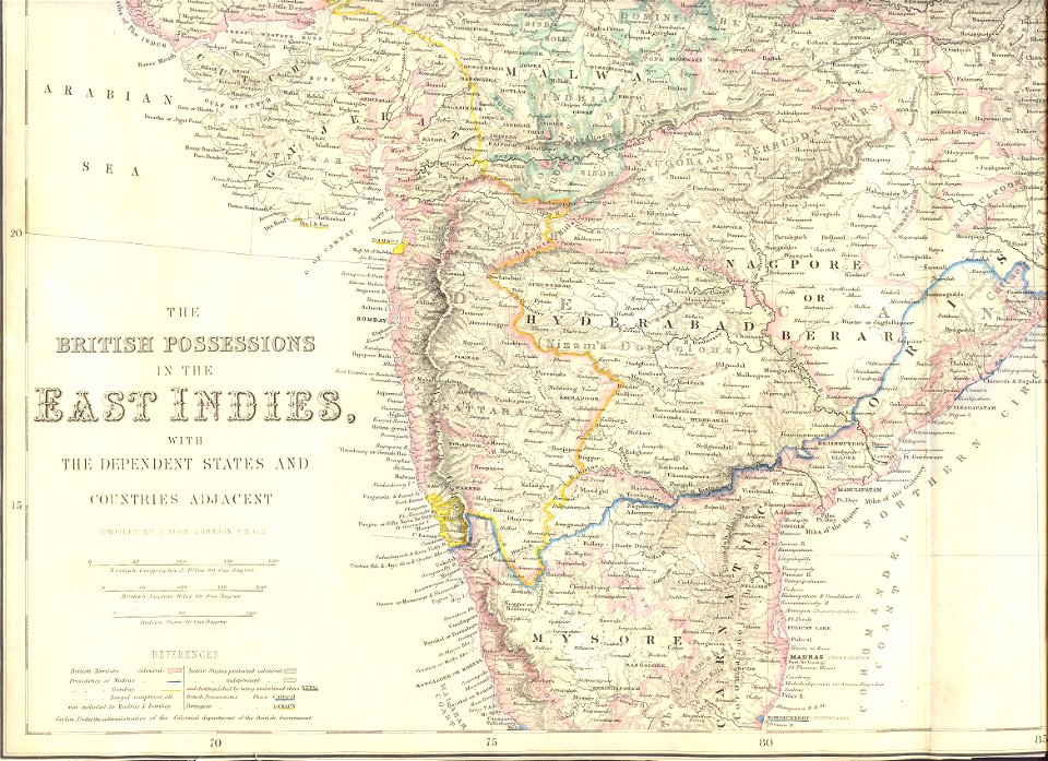
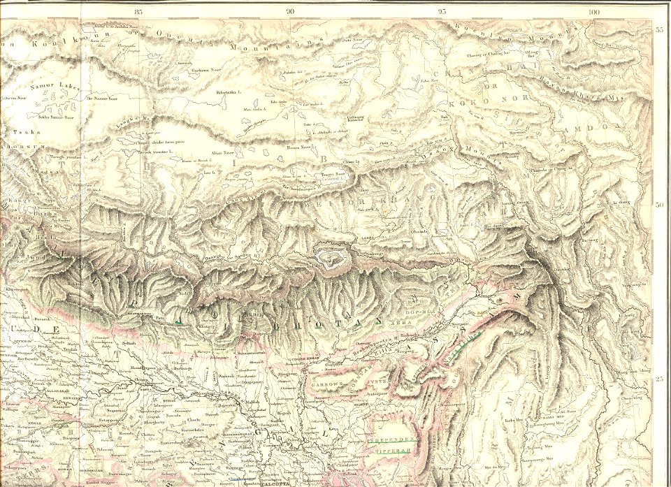
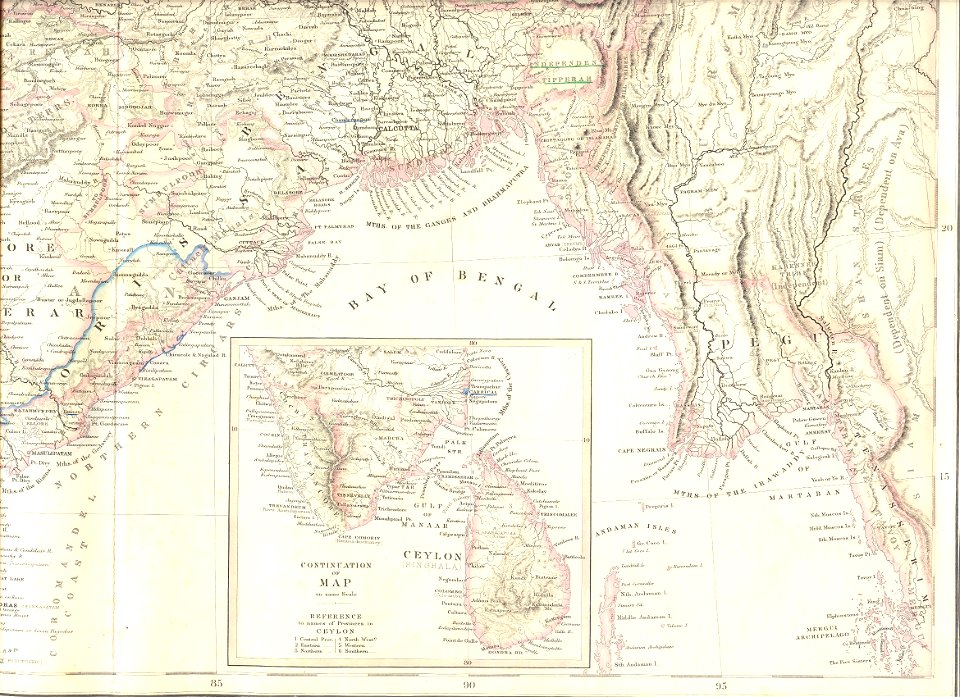
19th-century maps of india
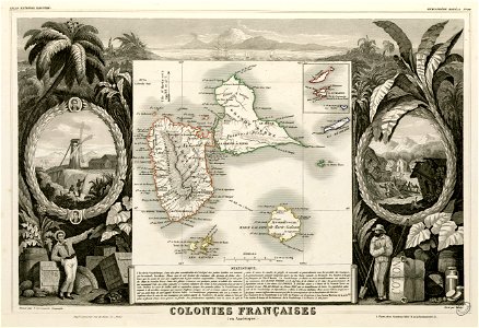
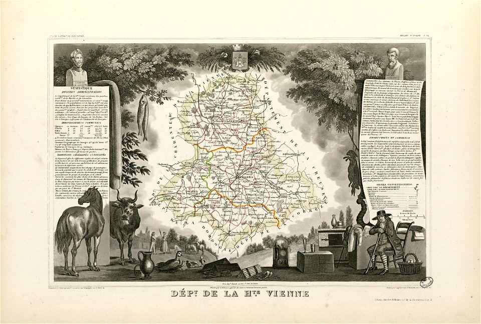
victor levasseur - maps of france
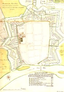
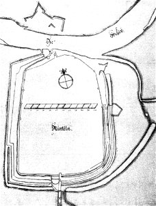
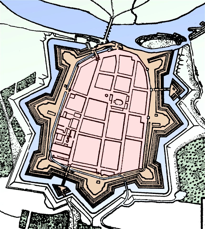
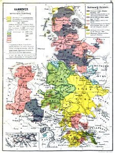
stadtbefestigung rinteln
maps of rinteln
maps made in the 17th century
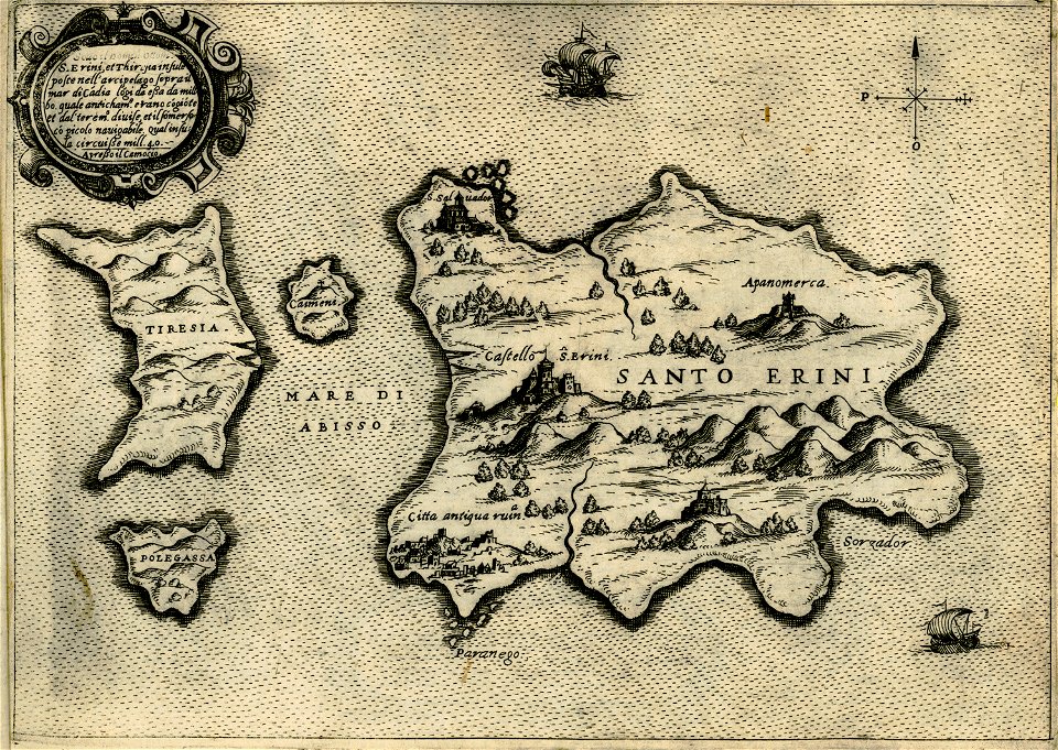
giovanni camocio
gerard valck
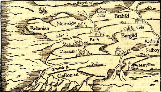
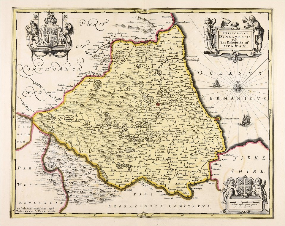
maps in the british museum
maps in the british museum
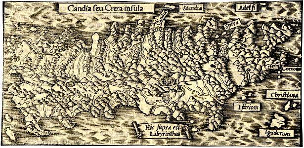
maps in the british museum
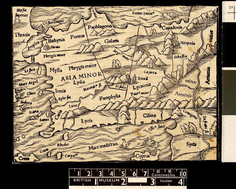
maps in the british museum
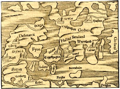
maps in the british museum
maps in the british museum
maps in the british museum
maps in the british museum
maps in the british museum
maps in the british museum
maps in the british museum
maps in the british museum
maps in the british museum
maps in the british museum
maps of lars kietzlingh
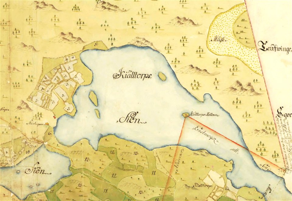
källtorpssjön
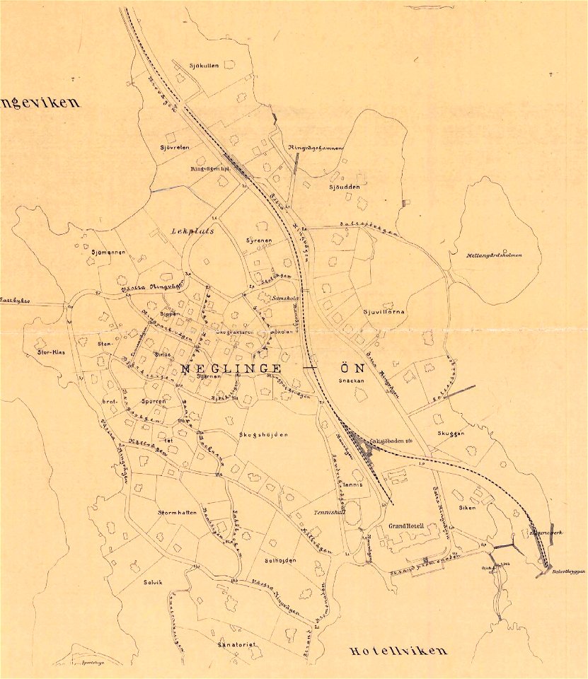
saltsjöbaden
maps
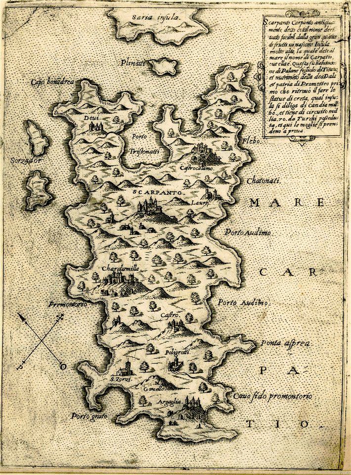
maps of karpathos
giovanni camocio
maps in the british museum
maps in the british museum
maps in the british museum
maps in the british museum
maps about santorini
giovanni camocio
giovanni camocio
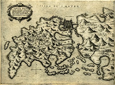
maps of lefkada
people with maps in art
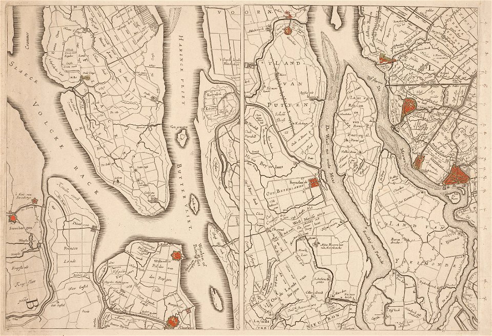
maps in the amsterdam museum
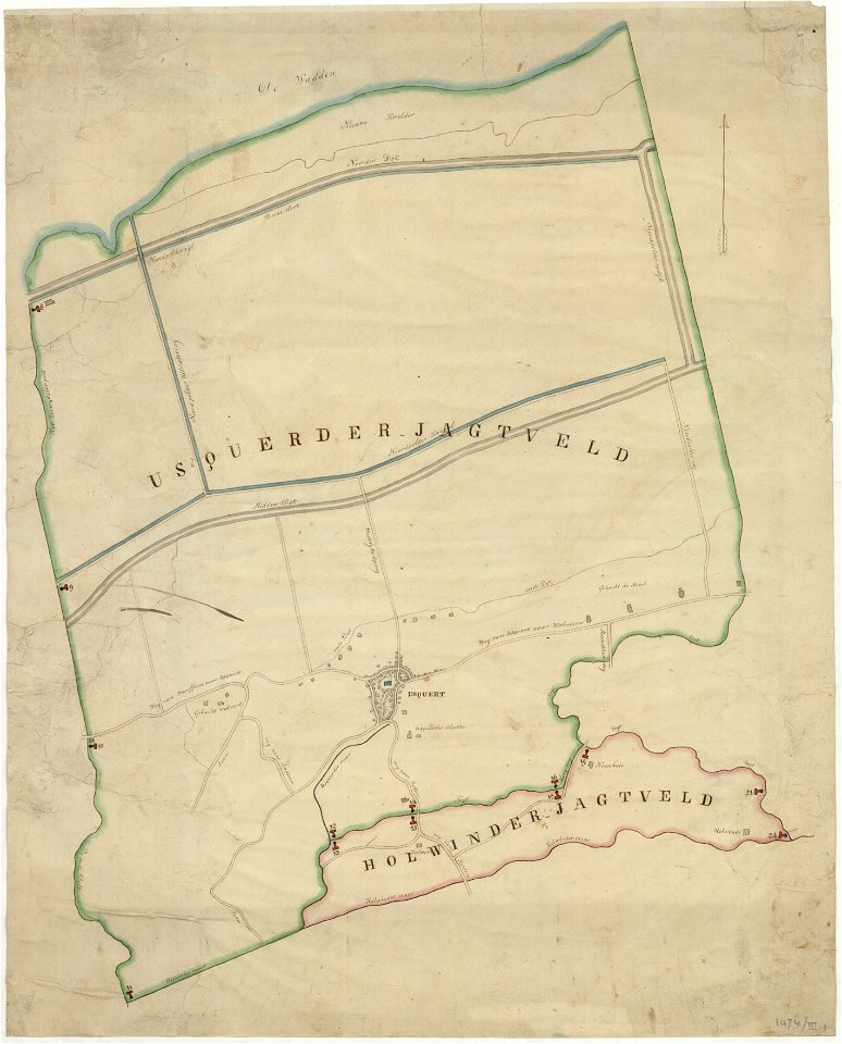
holwinde
usquert
maps of de marne
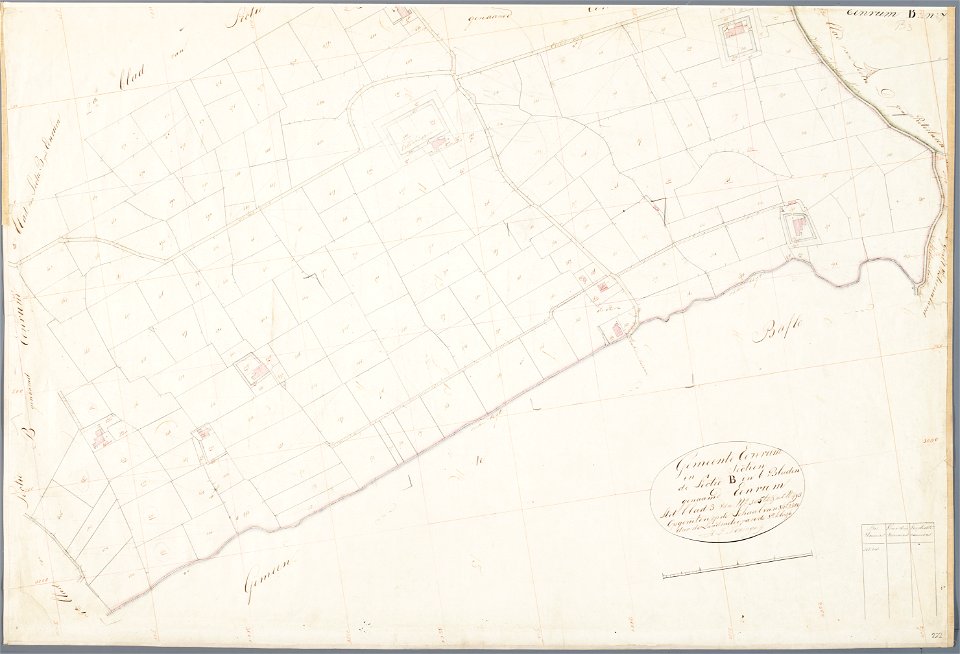
eenrum
maps in the amsterdam museum
kammeckers malmgård
maps of östermalm
maps of de marne
eenrum
maps of berlin-wannsee
böttcherberg
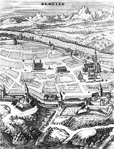
old maps of kempten (allgäu)
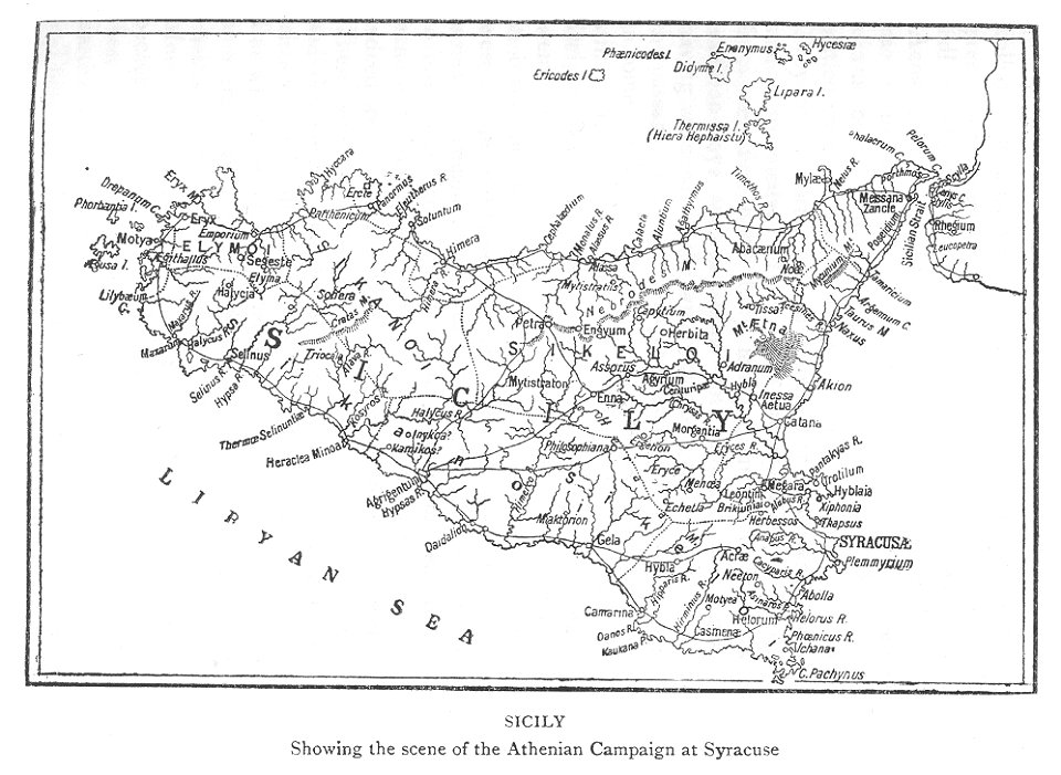
maps of the sicilian expedition
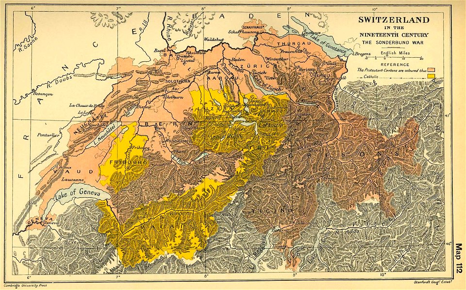
maps of the sonderbund war
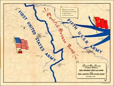
maps of world war ii
stadtbefestigung rinteln
maps of rinteln
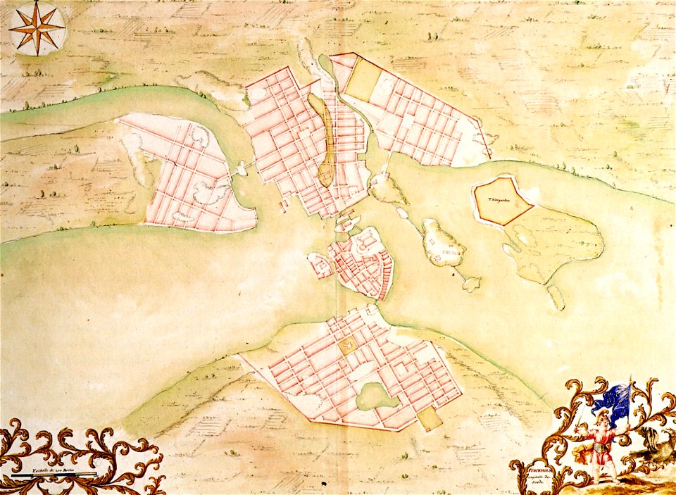
17th-century maps of stockholm
17th-century maps of stockholm
stadtbefestigung rinteln
maps of rinteln
stadtbefestigung rinteln
maps of rinteln
19th-century maps of india
19th-century maps of india
maps in the amsterdam museum
maps in the amsterdam museum
maps in the amsterdam museum
19th-century maps of india
19th-century maps of india
19th-century maps of india
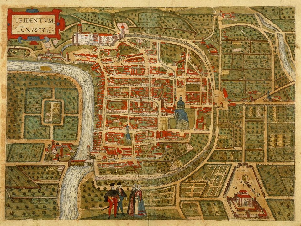
old maps of trento
engraving
stadtbefestigung rinteln
maps of rinteln
maps in the amsterdam museum
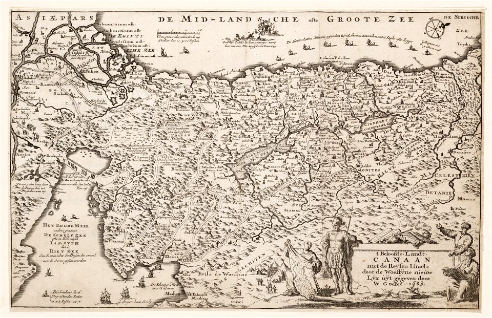
18th-century maps of hispaniola
hispaniola
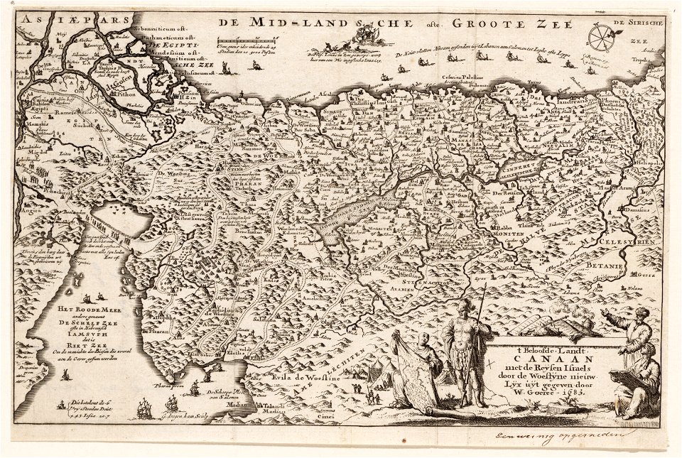
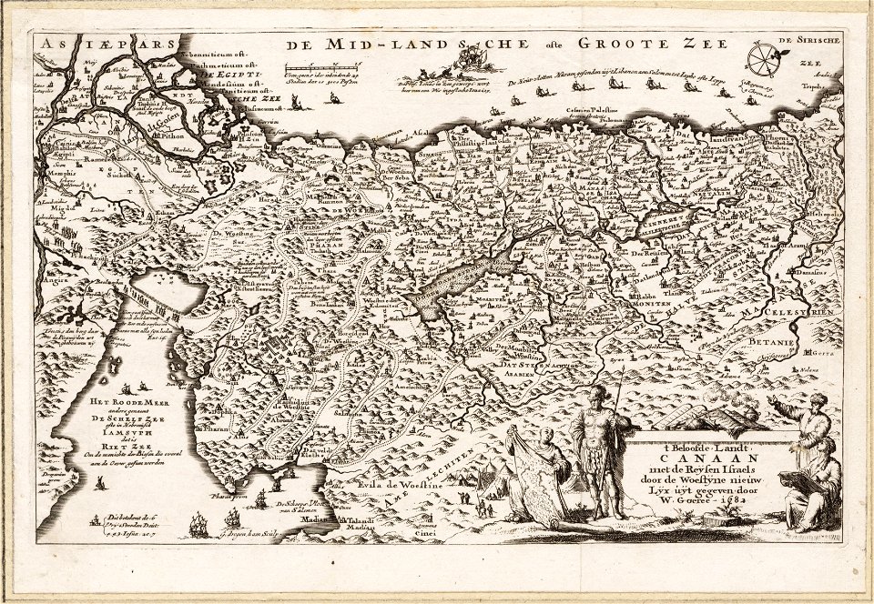
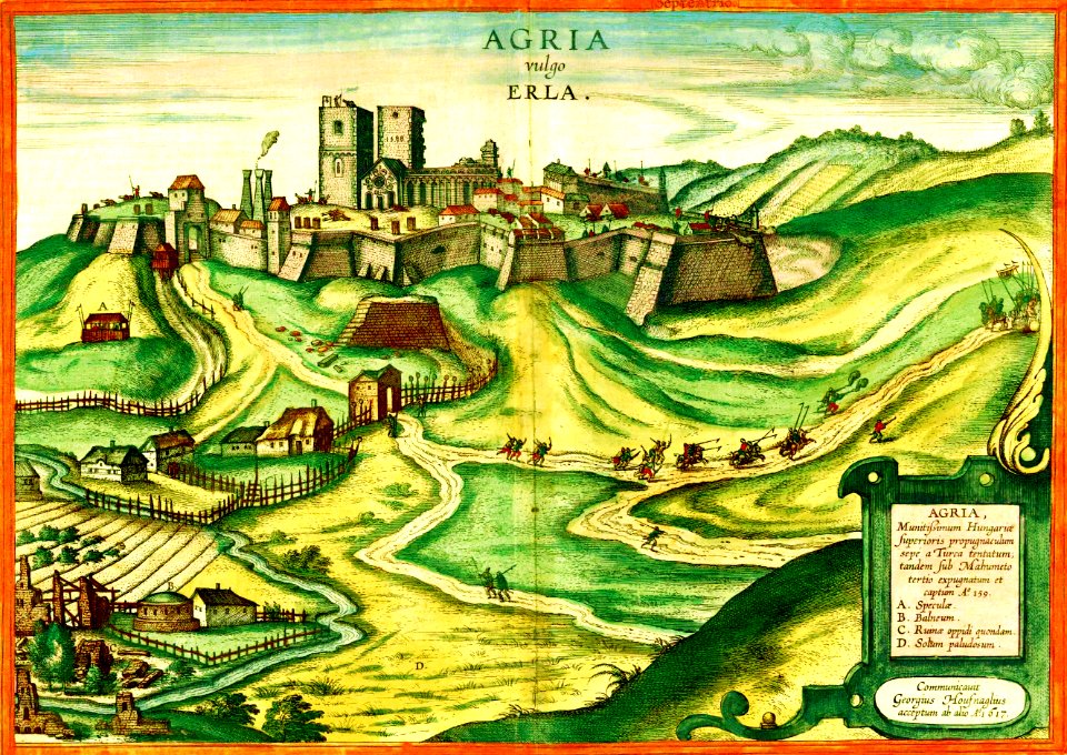
maps and topographical views by joris hoefnagel
braun & hogenberg
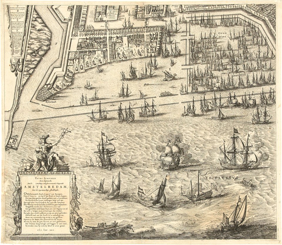
dutch 17th-century prints in the rijksmuseum amsterdam
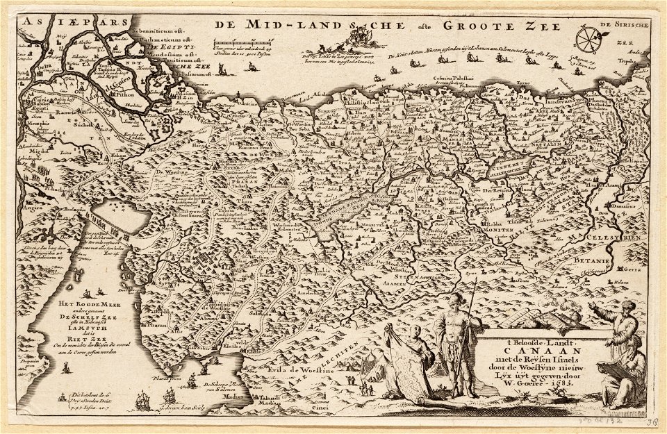
petrus scriverius
maps by nicolas sanson
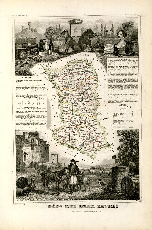
maine-et-loire
trịnh lords
1747)
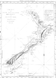
new zealand
geography
fonds ancely - bibliothèque municipale de toulouse - maps
victor levasseur - maps of the world
coats of arms of cities in loire
frédéric-auguste laguillermie
fonds ancely - bibliothèque municipale de toulouse - maps
victor levasseur - maps of france
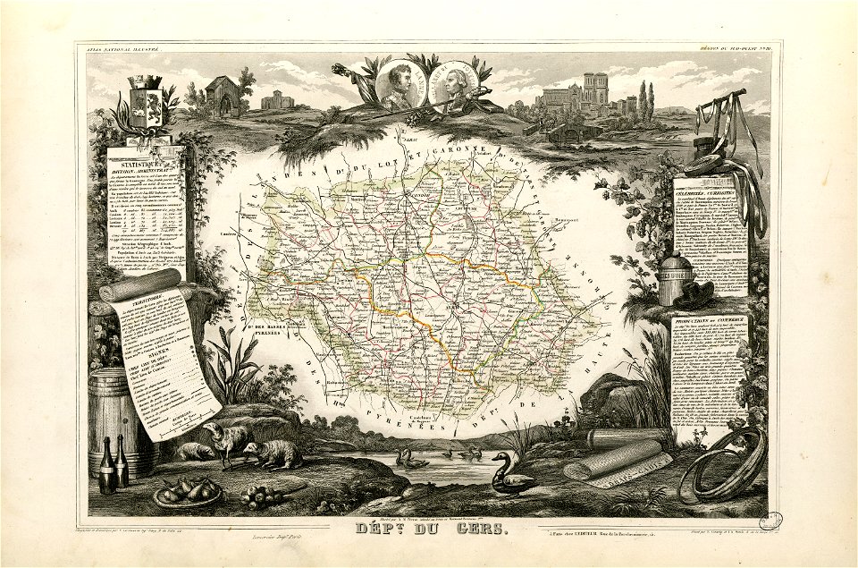
coats of arms of auch
jean lannes
fonds ancely - bibliothèque municipale de toulouse - maps
frédéric-auguste laguillermie
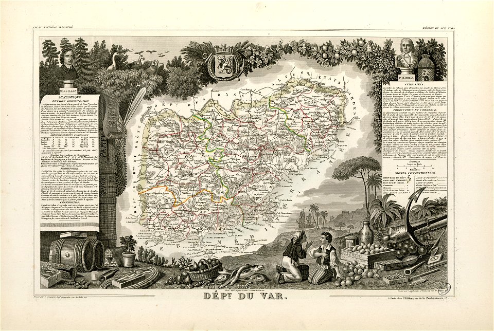
coats of arms of cities in var
old maps of var
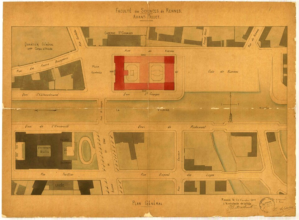
jean-baptiste martenot
1888 in bretagne
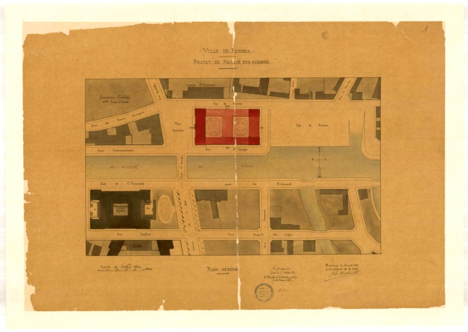
jean-baptiste martenot
1888 in bretagne
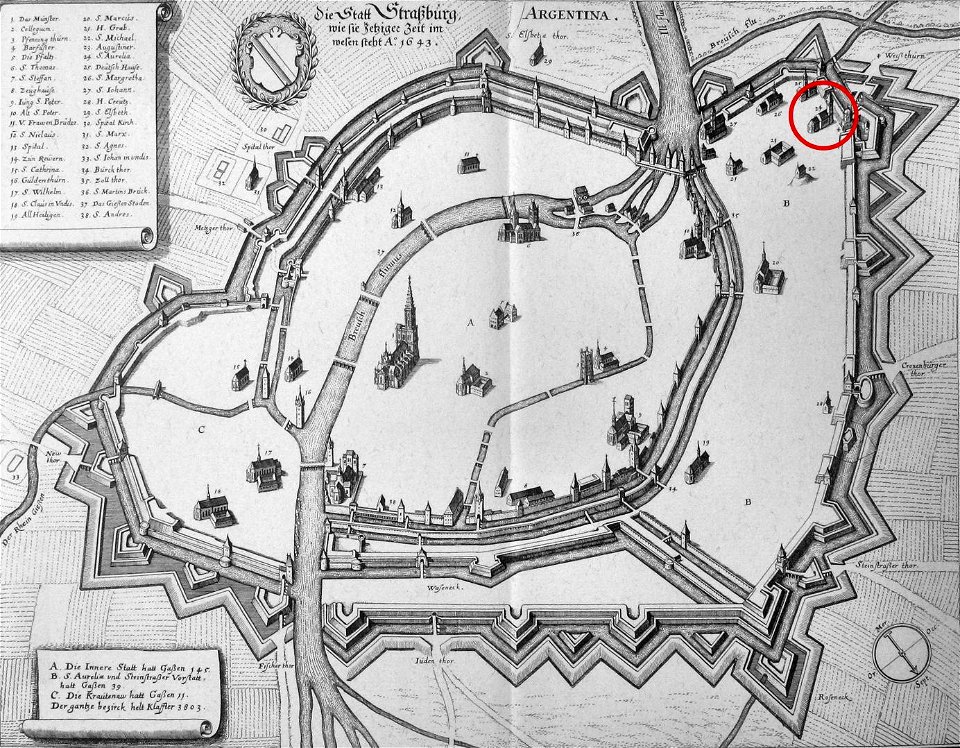
église sainte-aurélie
strasbourg
maps made in the 17th century
gerard valck
maps made in the 17th century
gerard valck
old maps of the sea of azov
1856 maps
maps by nicolaes visscher i
claes jansz. visscher (ii)
johann baptist homann
maps
1726
asie
1700s maps of baden-württemberg
bishopric of constance
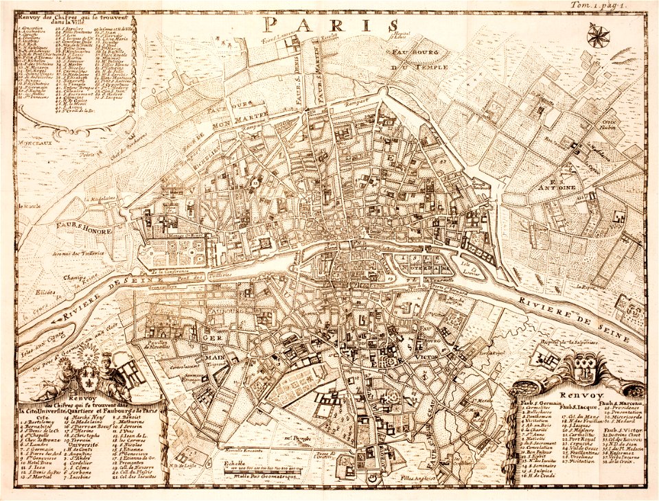
18th-century maps of paris
maps of paris in the 1740s
a voyage to terra australis
1814 engravings
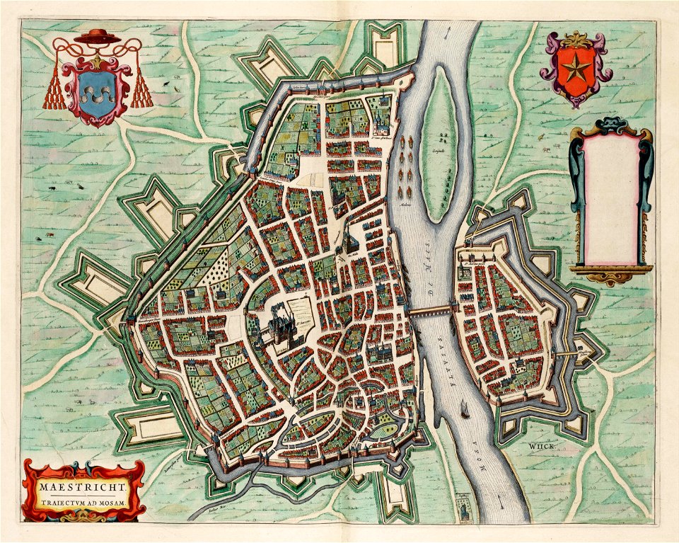
coats of arms of maastricht
coats of arms on maps
india
diu
maps from the mechanical curator collection
1869 maps
1880 maps of france
auguste logerot
amelisweerd
zuiderzee
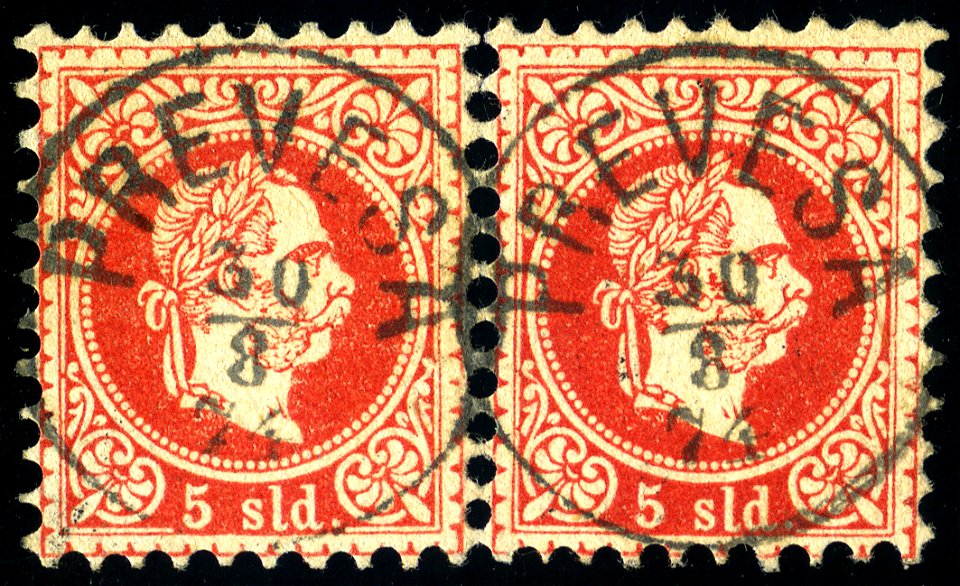
postmarks of preveza
1874 postmarks
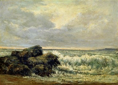
1867 paintings
boston
oil paintings of seascapes by gustave courbet
1860s paintings from france
artworks with known accession number
artworks without wikidata item
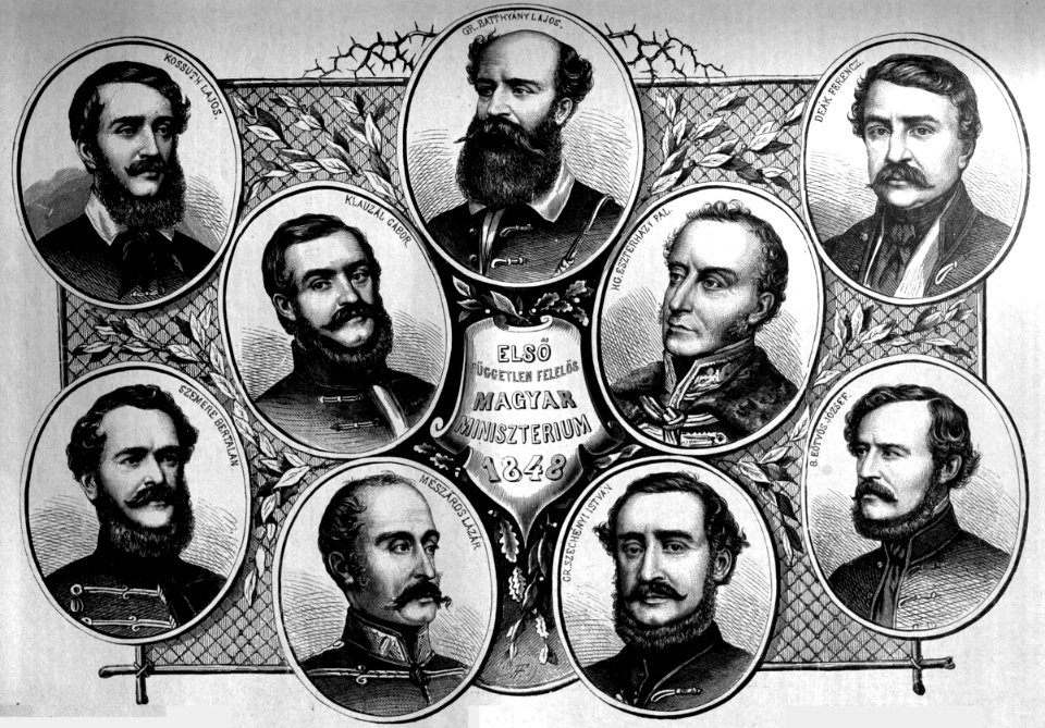
portraits of istván széchenyi
gábor klauzál
list of paintings by dante gabriel rossetti
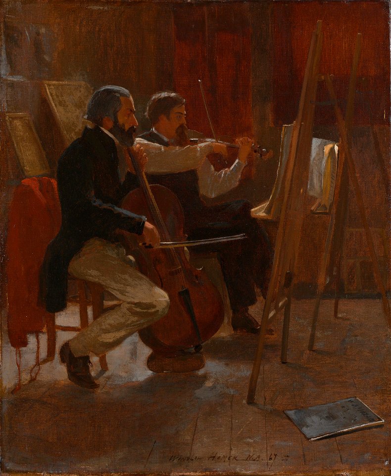
music in art
1867 births
cambridge
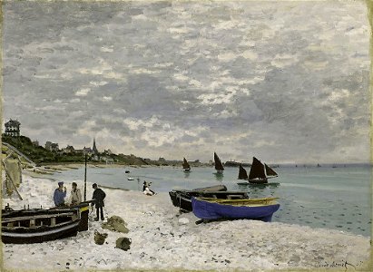
1860s paintings by claude monet
sainte-adresse by claude monet
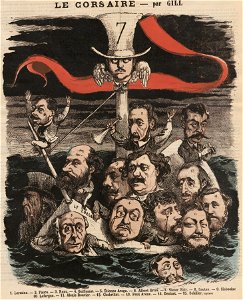
1867 cartoons
andré gill
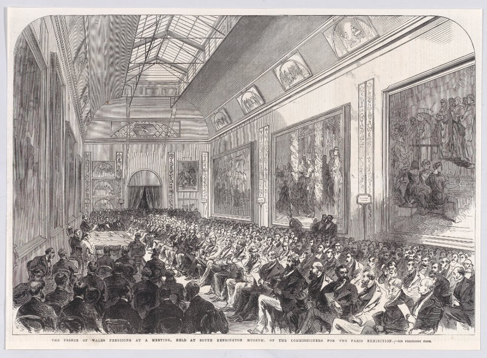
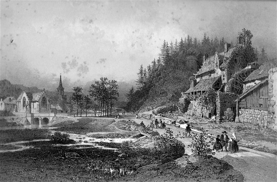
1867 engravings
eugène cicéri
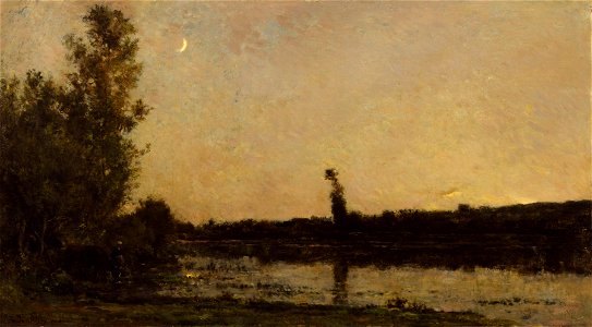
1860s paintings from france
1860s landscape paintings
1860s paintings by winslow homer
1867 paintings
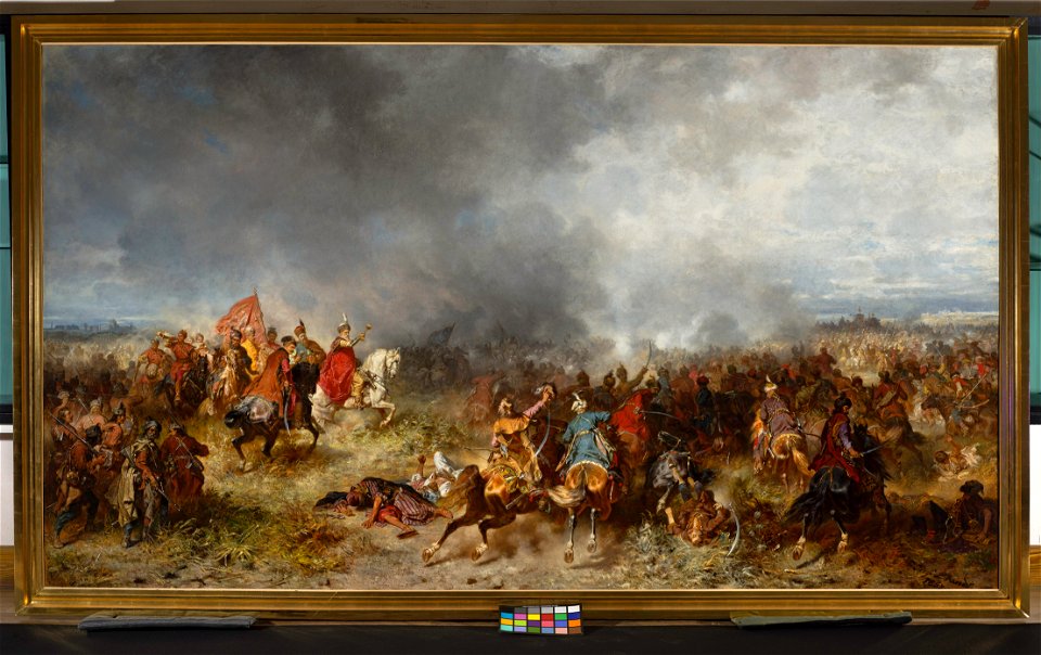
19th-century paintings of battles
1867 paintings
ogier gisleen van busbeke
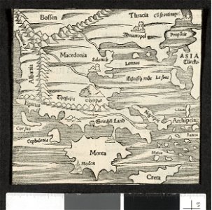
1620 maps of europe
maps by willem and johannes blaeu
joan blaeu
maps made in the 16th century
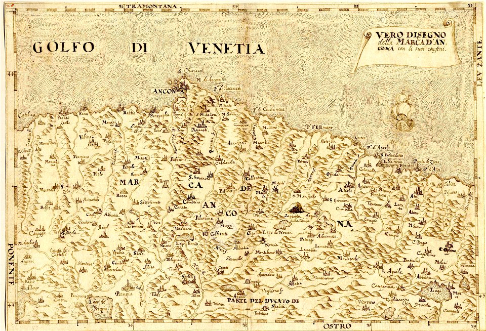
maps of the march of ancona
maps made in the 16th century
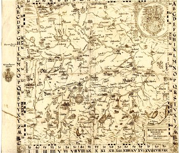
old maps of bavaria
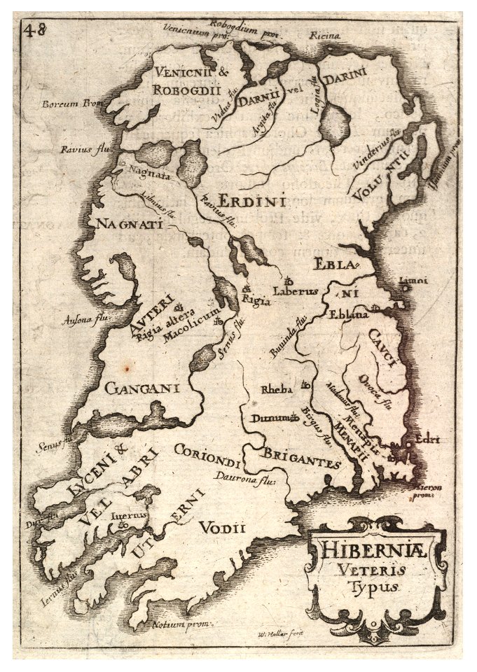
university of toronto wenceslas hollar digital collection
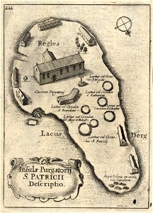
old maps of ireland
university of toronto wenceslas hollar digital collection
old maps of ireland
university of toronto wenceslas hollar digital collection
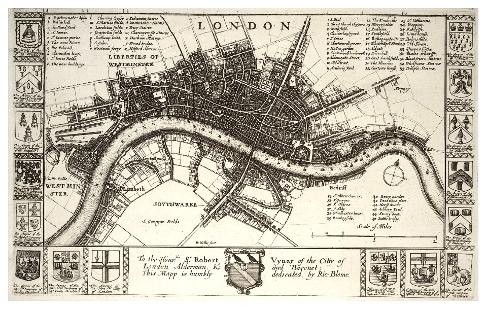
hollar maps and plans of london
5701 - 5800 of 37,071
Next page
/ 371